SELA LUXURY • COLLECTED OBJECTS
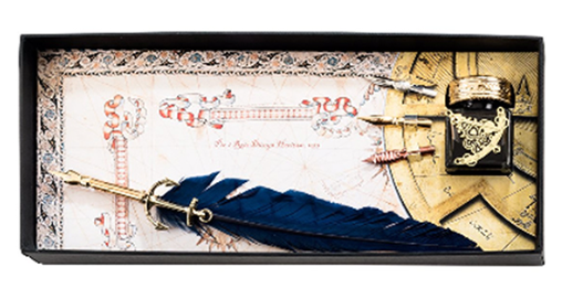
SalePIRI REIS YAZI SET
RM1,800.00 MYRRM1,440.00 MYR
The Piri Reis World Map, prepared by integrating information from twenty maps, including the now-lost map of Christopher Columbus, is a valuable historical document containing geographical knowledge from 16th-century European and Muslim sailors.
The first world map drawn by Ottoman admiral Piri Reis in 1513 is one of the oldest maps showing the Americas. The map depicts the west coasts of Europe and Africa and the east coast of South America. The original map, decorated with colors, pictures and writings on gazelle skin, is kept at Topkapı Palace.
Dimensions: 13 × 33 cm
Color: Navy Blue
Product origin: Italy
Care: Wipe with a dry cloth.
Please check availability and delivery details before ordering.